
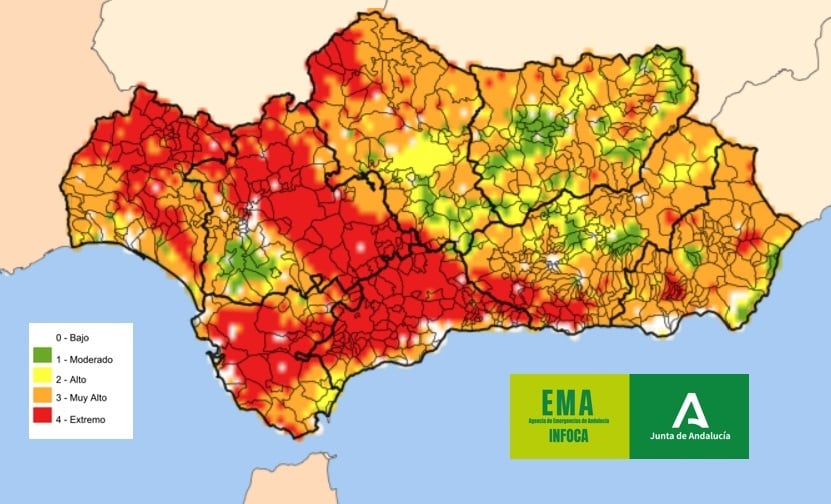
Spain is set to face very high or extreme wildfire danger across most of the country from Tuesday, it has been announced.
It comes as a fresh spell of intense heat pushes temperatures back towards the mid-40s, the national weather agency Aemet warned on Monday.
The agency says a new hot weather episode will dominate the week, bringing a widespread rise in temperatures and almost no rainfall, particularly across the Mediterranean coast and southwest Spain.
The warning comes after a relatively cool weekend for the time of year, with temperatures now climbing rapidly once again.
153,000 hectares burnt this year
According to the European Copernicus monitoring service, 153,000 hectares have already been destroyed by wildfires in Spain this year – well above the 20-year annual average of 95,000 hectares, underlining the severity of the current fire season.
On Monday, temperatures are already expected to exceed 38C in parts of Extremadura and the Guadalquivir Valley, while strong Levante winds in the Strait of Gibraltar and Cadiz countryside will further increase the fire risk.
By Tuesday, temperatures will rise across almost the entire country.
Night-time lows of 22C to 24C are forecast in Mediterranean regions, Extremadura and the Guadalquivir Valley, while daytime highs of 36C to 38C will become widespread away from the coast.
Temperatures of 38C to 40C are expected in southern Galicia, the Ebro Valley and much of central and southern Spain, with more than 40C possible in the Tagus, Guadiana and Guadalquivir valleys.
Dry, sunny conditions are expected to continue throughout the week, keeping wildfire danger at high or extreme levels across most of Spain.
On Wednesday, only isolated thunderstorms are forecast over parts of the eastern interior, while the Levante wind is expected to strengthen again around the Strait of Gibraltar and Cadiz province.
Temperatures will continue to climb, with highs exceeding 36C to 38C across much of the country and 40C or more possible in parts of the Ebro Valley, eastern Cantabria and low-lying areas of central and southern Spain.
Although forecasts become less certain later in the week, meteorologists expect the intense heat to persist, with only a slight chance of light rain along the Cantabrian coast.
Weekend hottest days of the week
Friday and Sunday are currently forecast to be the hottest days of the week.
Temperatures could reach 44C around Cordoba, while Toledo, Zaragoza and Ciudad Real may exceed 42C.
Some Saharan dust and increased cloud cover could slightly limit temperatures in parts of the south.
Meanwhile, southeastern winds are expected to drive temperatures above 37C in Bilbao on Tuesday, while tropical nights are forecast to return across much of southern and Mediterranean Spain.
Weather forecasters at Meteored also warned that temperatures this week could run up to 4C above normal across parts of the Pyrenees, the Ebro Valley and central-eastern Castilla y Leon, highlighting the exceptional nature of the latest heat event.
At risk areas in Malaga
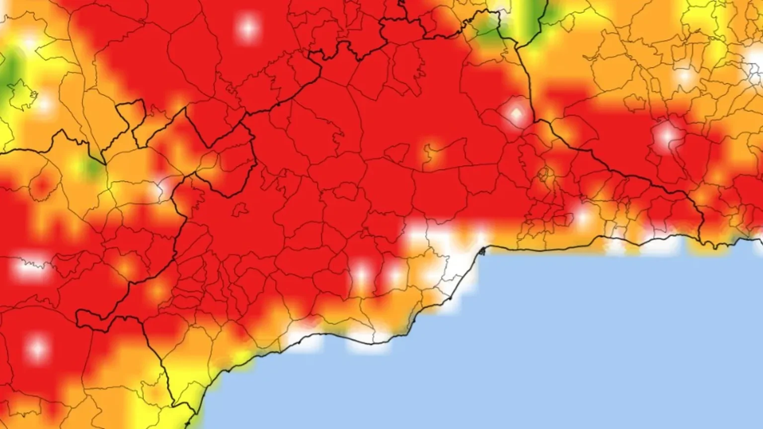
Malaga province is among the areas facing an extreme risk of wildfires from this Monday after fire danger shifted westwards across Andalucia, according to the regional Infoca wildfire service.
The Andalucian Emergency Agency (EMA) said the highest level of fire risk has now moved from eastern Andalucia to the western half of the region, placing almost the entire province of Malaga under the maximum alert.
The warning comes after firefighters tackled two separate wildfires on Sunday.
One broke out near Arroyo España, alongside the A-7 motorway in the Puerto de la Torre area of Malaga city, while another erupted in the Cerro del Aguila area of Colmenar.
The fire risk is expected to ease gradually over the coming days.
According to forecasts from Aemet, the highest level of danger will remain on Tuesday in the inland districts of Antequera and Ronda.
The Axarquia will drop to a high (orange) risk level, while coastal areas will remain at low risk.
Across the Costa del Sol and Guadalhorce Valley, the danger will be greatest inland before decreasing closer to the coast.
By Wednesday, only the northern part of the province around Antequera is expected to remain under the highest level of alert.
On Thursday, most of central Malaga will be classified as very high risk, while the coast will remain at low or very low risk, with surrounding areas classified as moderate.
However, forecasters expect the extreme risk to spread once again across the northern half of the province by the start of the weekend, while coastal areas continue to benefit from lower danger levels.
The heightened risk comes as temperatures remain well above average for late July. Although no official heat warnings are currently in force, highs of around 30C are expected along the coast and up to 35C inland this week.
Meanwhile, smoke from the major wildfires burning in central Spain, which drifted into parts of Andalucia over the weekend, is expected to clear on Monday as easterly winds disperse the haze, according to the EMA.
Read more Andalucia news at the Spanish Eye.