
After weeks dominated by a stubborn high-pressure system blocking rain from reaching much of Spain, especially from the Atlantic, the weather is about to shift.
While the Mediterranean coast has seen episodes of heavy rainfall from isolated low-pressure systems, the rest of the country – especially the southwest – has remained dry.
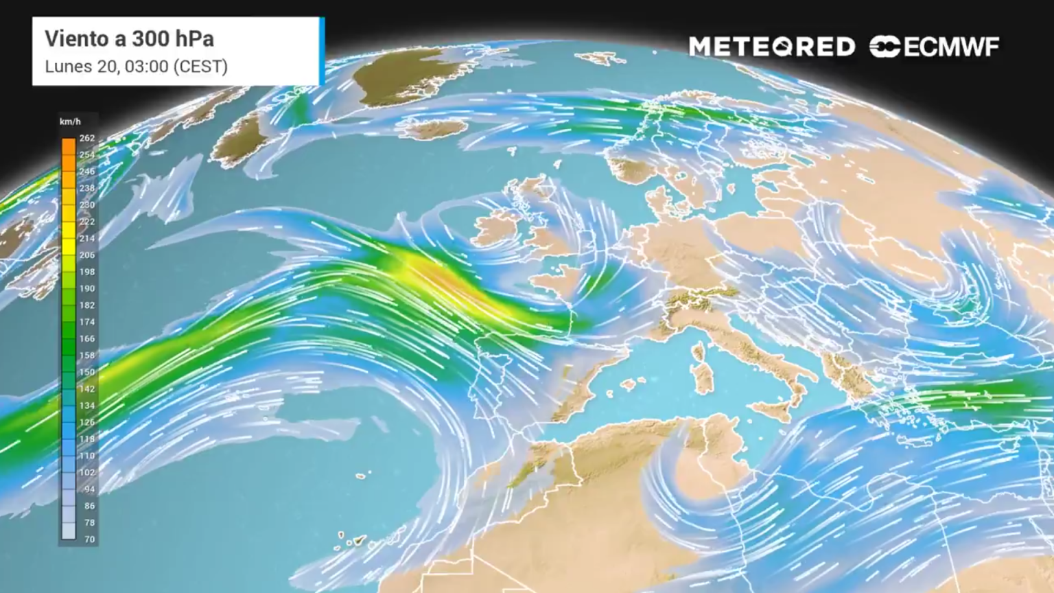
The atmospheric block that’s been suppressing rain is beginning to weaken. Forecast models show this high-pressure ridge breaking down over the coming days, giving way to a more typical autumn setup.
This means a stronger pressure difference between Iceland and the Azores, which fuels a fast, active polar jet stream across the mid-latitudes.
This shift allows large storm systems to form and move eastwards across the North Atlantic. While this isn’t expected to be a particularly strong or long-lasting pattern, it will dominate for at least the next week.
What does this mean for Andalucia?
For Andalucia, the return of Atlantic storms will not mean a return of meaningful rain.
The incoming systems will mostly impact northwest Spain, with heavy and persistent showers expected in Galicia and northern Portugal, and possibly in mountainous areas like Sanabria, Gredos, and Bejar.
Further inland and across the southern half of the country – including Andalucia – rain will be patchier and much less likely, especially along the Mediterranean coast.
So while the northwest gets relief from drought, southern regions may continue to miss out.
Winds picking up – especially in the north and mountains
From Sunday onwards, westerly and southwesterly winds will strengthen across much of Spain, especially midweek.
Strong gusts could exceed 70 km/h in exposed areas, particularly in the north and mountain regions. These winds may pose a fire risk in dry areas.
Temperatures staying mild or even rising
Despite talk of a ‘polar blast,’ this won’t be a cold snap for Andalucia. In fact, temperatures could climb in several regions.
That’s because the air mass being pushed in from the Atlantic has subtropical maritime origins (mild and humid).
As it moves across Spain, the foehn effect (air warming and drying as it descends over mountains) could raise temperatures even further, particularly in eastern and southern regions.
Highs along the Costa del Sol next week, for example are expected to reach as high as 28C, with inland areas climbing to 30C, including Sevilla.