
Fears are growing of violent storms in Spain in the coming weeks due to consistently high sea temperatures.
Patches of the Mediterranean have now reached up to 32C, prompting warnings that it could provide extra fuel for powerful storms as the end of summer beckons.
Large areas of the sea are currently sitting at between 28C and 30C, while parts of the western and central Mediterranean and the Tyrrhenian Sea have climbed even higher.
The warning of powerful DANAs has been issued by Aemet physicist and meteorologist Juan Jesus Gonzalez Aleman.
He explained that exceptionally warm water can provide greater amounts of heat and moisture to the atmosphere, potentially intensifying storms when the other necessary meteorological conditions come together.
He wrote in a post on X: ‘Second half of August, and the typical troughs or significant DANAs that mid-latitude circulation sends our way are already starting to arrive.
‘With an ocean so extremely warm, these troughs/DANAs have more fuel available – and of higher quality – to develop storms of very high impact. So, stay alert over the next few days.’
Severe and extreme marine heatwave
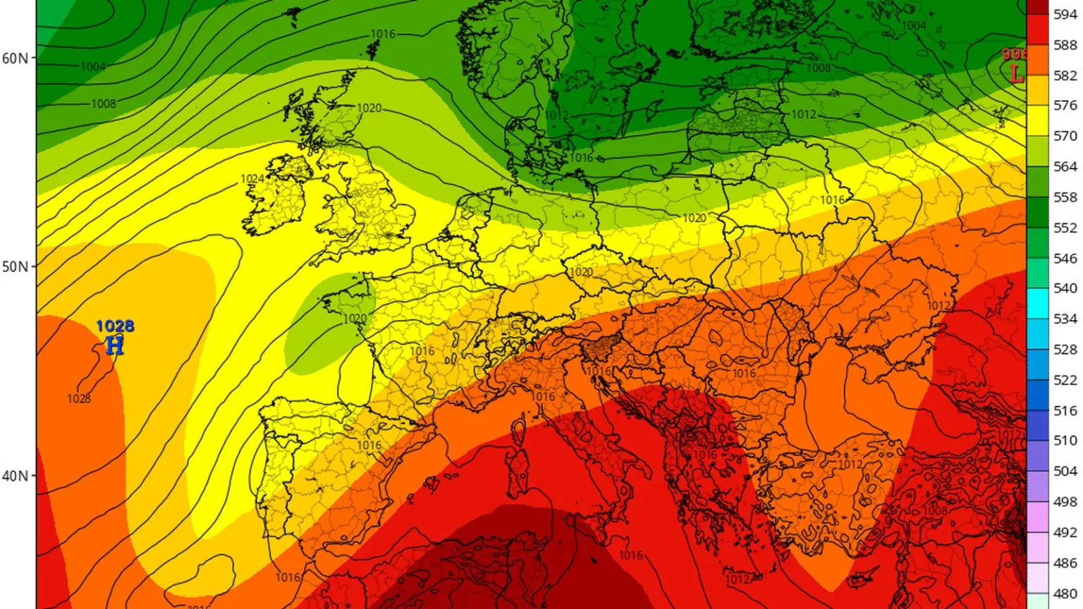
Maps produced by the Mediterranean Centre for Environmental Studies (CEAM) show unusually warm waters across much of the Mediterranean.
More significantly, large areas are experiencing a marine heatwave classified as severe or extreme compared with the 1991-2020 reference period.
The Balearic Islands, Gulf of Lion, Ligurian Sea and Tyrrhenian Sea are among the areas particularly affected.
Gonzalez Aleman has drawn attention to the repeated occurrence of exceptionally warm Mediterranean waters during recent summers.
And with the second half of August underway, the meteorologist warned that incoming troughs could find more – and higher quality – ‘fuel’ available for the development of potentially high-impact storms.
Warm seas increase evaporation and can load the lower atmosphere with additional moisture.
If an unstable weather system subsequently arrives, that moisture can become one of the ingredients necessary for torrential rainfall and severe thunderstorms.
Disaster is not guaranteed
The current conditions do not constitute a forecast that a major DANA or extreme storm will hit Andalucia in the coming days.
Nor can meteorologists predict weeks in advance exactly where torrential rainfall might develop.
Instead, the extraordinarily warm Mediterranean represents an important background factor that forecasters will be watching closely as the atmospheric pattern begins its gradual transition towards late summer and autumn.
If a favourable setup for severe thunderstorms does emerge, the abundance of heat and moisture stored in the sea could increase their potential intensity.