
Spain could be heading for a brutally hot summer, with meteorologists warning that an emerging ‘Super El Niño’ phenomenon may turn the country into a ‘furnace’ in the coming months.
The warning comes after an unusually intense start to spring, which has already seen temperatures soar past 30C in parts of the country – including areas in the north where such heat is highly unusual for this time of year.
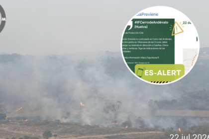
As ever, Andalucia is currently recording the highest temperatures nationwide and is set to be among the Spanish regions most impacted by the El Niño phenomenon.
The southernmost region repeatedly records the hottest temperatures each summer, with the gong last year going to Jerez de la Frontera, where the mercury reached 45.8C on August 17.
According to meteorologist Luismi Perez, speaking on Cadena SER, the early spike in temperatures this year may be just the beginning.
What is ‘Super El Niño’?
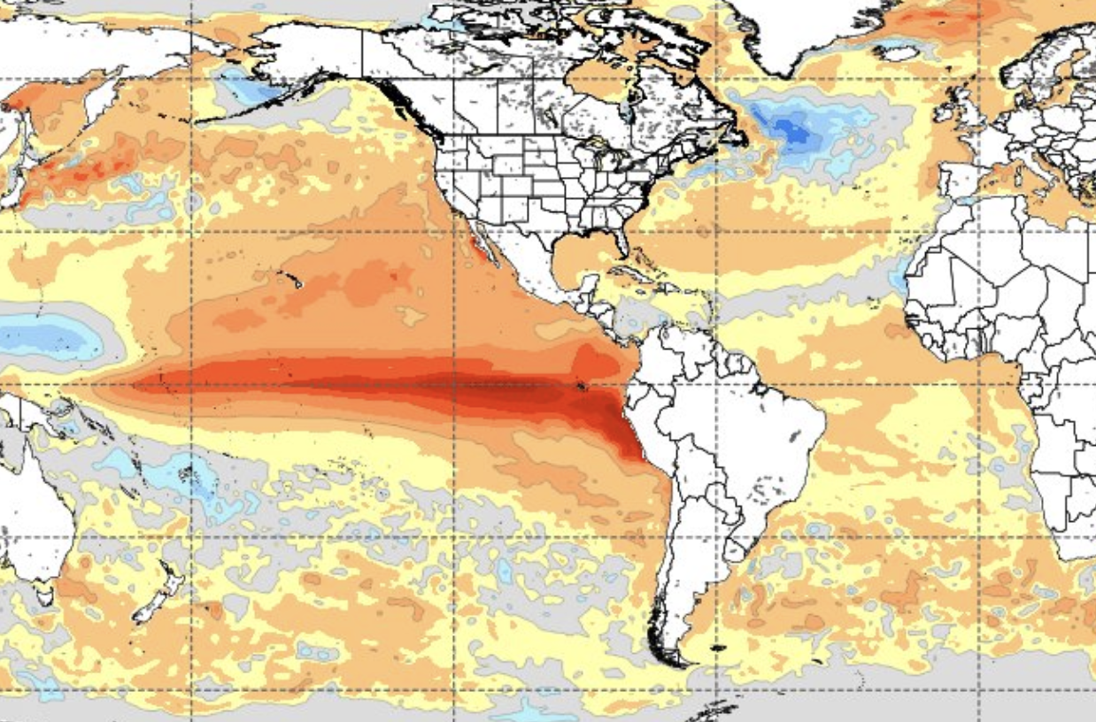
El Niño is a climate phenomenon driven by the warming of surface waters in the Pacific Ocean.
While it originates thousands of kilometres away, its impact is global, affecting weather patterns across Europe, including Spain.
Perez described it as one of the clearest examples of ‘teleconnection’ on Earth, which is a chain reaction where conditions in one part of the planet influence weather on the other side.

The stronger the warming in the Pacific, the greater the knock-on effect.
A delayed but dangerous impact
While the phenomenon is already intensifying, its full impact on Spain is expected to be felt in the coming months, potentially peaking during the height of summer.
‘The more powerful El Niño is, the higher the temperature of the ocean and the greater its impact on Europe,’ Perez explained.
That could translate into sustained and extreme heat across much of Spain, particularly if African air masses begin to push northwards more frequently, which is a scenario meteorologists say is increasingly likely.
A ‘perfect storm’ for extreme heat
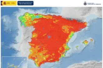
Experts warn that several factors could align to produce a worst-case scenario.
A strong El Niño event often leads to the formation of persistent high-pressure systems over Europe.
If such an anticyclone settles over the Iberian Peninsula, it can trap heat, block rainfall and allow hot air from North Africa to dominate.
The result is prolonged heatwaves and extreme temperatures across most regions.
‘There could be moments of intense heat at the worst possible time,’ Perez warned.
One region may escape
If the high-pressure system shifts in a way that brings northerly winds, the Cantabrian coast could be spared the worst of the heat, however.
These cooler Atlantic flows may provide some relief in northern regions, although forecasters stress this remains uncertain.
Early warning signs
Meteorologists say the strength of the developing El Niño is already being felt globally, with unusually powerful hurricanes, typhoons and temperature spikes in regions that would not typically experience such extremes at this time of year.
Read more Andalucia news at the Spanish Eye.