
Google has launched a new experimental flood-risk map that allows users to check which areas are most exposed to flooding – including extreme flash floods and river flooding – anywhere in the world.
Here’s how to use it, and why it matters right now in Spain.
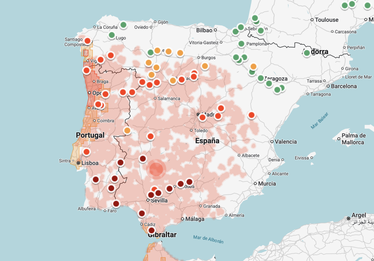
Why it’s useful now
At the time of writing, large parts of Spain are already waterlogged, meaning the ground can barely absorb any more rain.
With a new sequence of winter storms expected in February, the risk of flooding – especially sudden flash floods – is significantly higher.
On Wednesday this week, large parts of Andalucia are under alerts for storms, rain and winds – including a feared red alert for parts of Cadiz for extreme rainfall.
This is already clearly visible on Google’s map, as well as across western Spain, where flood risk indicators are already lighting up.
How to access Google’s flood-risk map
The tool has been developed by Google as part of its research projects. To view it:
- Go to sites.research.google/floods
- This opens a global interactive map
- A control panel appears on the right-hand side, allowing you to switch different visual layers on or off
By default, the map highlights areas with the highest risk of flash flooding worldwide.
How to use the map
You can:
- Zoom in on any country, region or town
- Switch to a hybrid view to see satellite imagery
- Pan across rivers, coastlines and urban areas
As you zoom in, you’ll see coloured markers indicating flood risk levels in specific locations.
What the information shows
Clicking on any of these markers opens a detailed information panel on the left-hand side of the screen. This includes:
- How flood risk is expected to evolve
- The type of flooding involved (for example, river or flash flooding)
- The data sources used to assess the risk
While the tool is still labelled as experimental, it offers a clear visual snapshot of where flooding is most likely, making it particularly useful during periods of prolonged rain or stormy weather.
For homeowners, drivers or anyone planning travel in bad weather, it’s a handy extra resource, especially as extreme rainfall events become more frequent.