
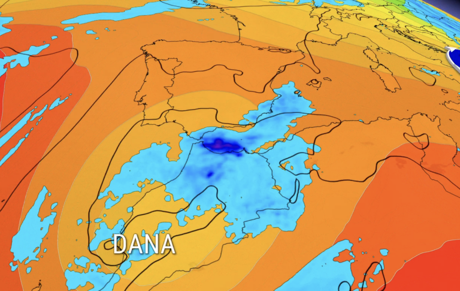

A DANA threatens heavy rain and thunderstorms in Andalucia during Spain’s upcoming holiday weekend, meteorologists have warned.
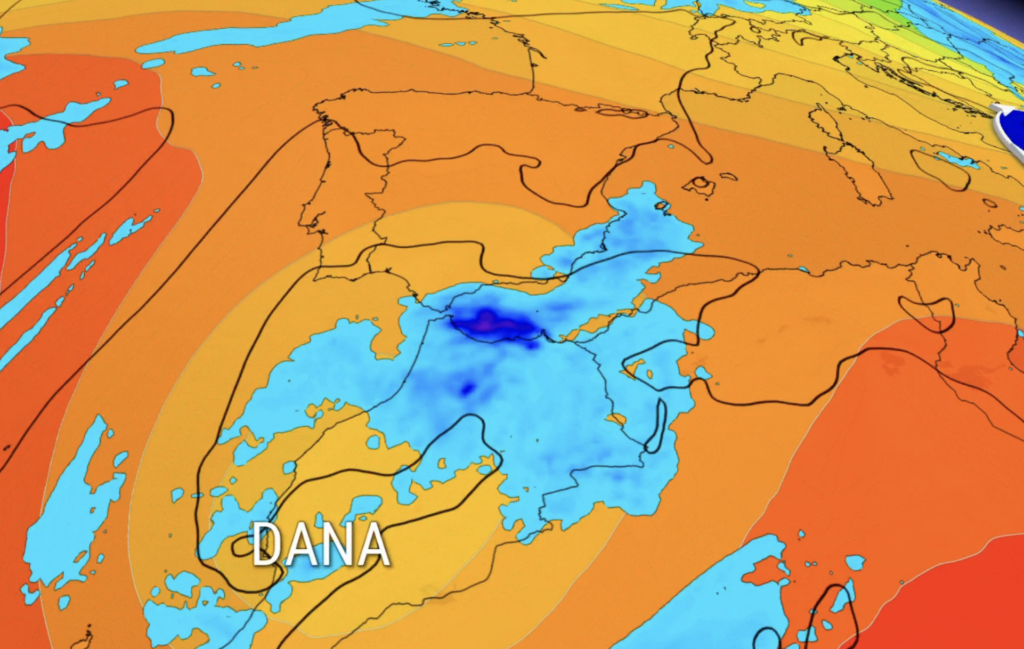
Weather models are monitoring the potential formation of an isolated area of cold air to the southwest of the Iberian Peninsula towards the end of the week.
The European ECMWF model suggests that the system could move across northern Africa and southern Spain between Friday, October 9, and Monday, October 12.
If it develops as currently projected, the heaviest rain could affect the southernmost areas of Andalucia, as well as Ceuta and Melilla.
According to projection maps, the DANA would affect the coast and some inland areas of Cadiz, the Costa del Sol and coast of Almeria.
However, its formation is not yet certain, and relatively small changes in its position would substantially alter where and how much rain falls.
Unsettled start to the week
Monday will remain affected by the instability that brought catastrophic flooding to Catalonia over the weekend.
Heavy rain and thunderstorms remain possible across the northeast and parts of western Spain.
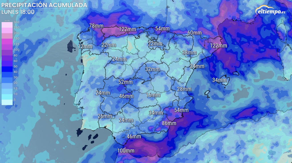
Girona has been placed under the highest-level warning, with the possibility of accumulations reaching 200mm in six hours in some areas.
Warnings are also in place across other parts of eastern Catalonia and sections of central and northwestern Spain.
Parts of Salamanca and Caceres face orange warnings, with up to 20 litres per square metre forecast in one hour.
Aemet continues to carry a special warning for very heavy and persistent showers and thunderstorms.
Showers Tuesday and Wednesday
The atmosphere will remain changeable on Tuesday and Wednesday, with irregular rain affecting different parts of mainland Spain.
The greatest likelihood of showers will be across northern and northeastern regions and mountainous areas.
The Mediterranean coast and the Balearic Islands could also experience locally intense showers and thunderstorms.
On the Costa del Sol, showers are expected every day this week bar Thursday, although there could be significant variations locally.
In inland Andalucia, including Sevilla, there will be intermittent showers Monday and Tuesday, before clearing up for the rest of the week.
Attention will then turn to the Atlantic and the possible development of the DANA southwest of Spain from Friday.
Temperatures closer to normal
Temperatures will fluctuate but should generally remain close to normal values for early October.
Madrid is expected to begin the week with maximums of around 23C before dropping to between 19C and 21C. Overnight temperatures could fall to between 8C and 10C.
Valencia will remain milder, initially reaching between 25C and 28C before maximums ease to around 22C to 24C later in the week.
Sevilla and Cordoba could still reach between 27C and 29C, while cities on the northern plateau, including Valladolid and Burgos, will frequently remain between 17C and 21C.
The outlook for Monday, October 12 – the Pilar holiday itself – is particularly uncertain.