
The Mediterranean’s record-breaking temperatures this summer are increasing the risk of powerful hurricane-like storms forming in Spain later this year, climate experts have warned.
It comes as a report from the Euro-Mediterranean Center on Climate Change (CMCC), shared with the Spanish Eye, shows the Med recorded its second consecutive record-breaking June for sea surface temperatures.
Scientists say conditions that were once considered exceptional are now becoming ‘the new normal.’
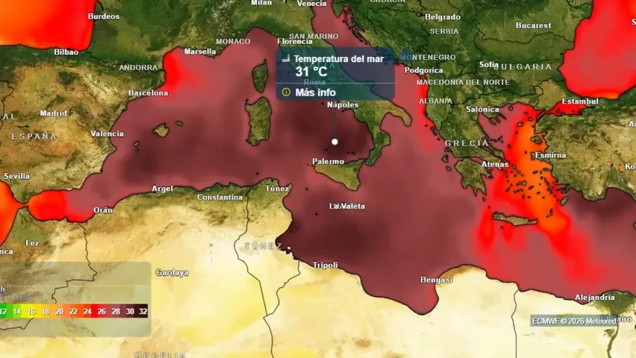
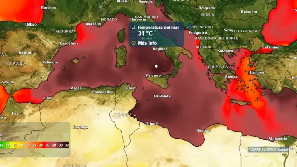
By the end of July, the Med’s average sea surface temperature had climbed to 26.6C, while some parts of Spain’s eastern coastline recorded water temperatures above 30C during successive heatwaves.
According to the CMCC, the Med has been experiencing an ongoing marine heatwave since late May, with sea surface temperatures peaking at around 27.3C in its western half, almost 3C above the long-term average.
In parts of the Gulf of Lion, temperatures were recorded 7C to 8C above normal for June.
Scientists say these marine heatwaves are becoming more frequent, more intense and longer-lasting, posing growing risks not only to marine ecosystems and fisheries but also to coastal weather patterns and extreme weather events.
Although the Med has traditionally been regarded as a relatively cool sea, experts say that is rapidly changing as global temperatures continue to rise.
One consequence is an increased concern over the formation of medicanes – Mediterranean cyclones that share some characteristics with tropical hurricanes.
Unlike Atlantic hurricanes, medicanes are generally smaller and less powerful, but they can still bring destructive winds, torrential rain, dangerous storm surges and severe flooding.
While the CMCC report focuses on marine heatwaves rather than medicanes specifically, climatologists say warmer sea temperatures provide one of the key ingredients needed for these storms to develop when cold air arrives in the upper atmosphere.
The warmer the sea becomes, the greater the amount of moisture and energy available.
When this collides with colder air higher in the atmosphere, the contrast can generate the unstable conditions needed for a medicane to form.
According to German climatologist Johannes Habermehl, writing for Meteored, the greatest risk comes during autumn.
At that time of year, the Mediterranean retains the heat accumulated over the summer while colder air masses begin moving in overhead, creating the ideal conditions for these rare storms.
One of the most notable recent examples was Storm Daniel in 2023, one of the deadliest medicanes on record, which caused catastrophic flooding in the Libyan city of Derna, killing thousands of people.
CMCC oceanographer Ronan McAdam warned that the hottest part of the Mediterranean summer may still be to come.
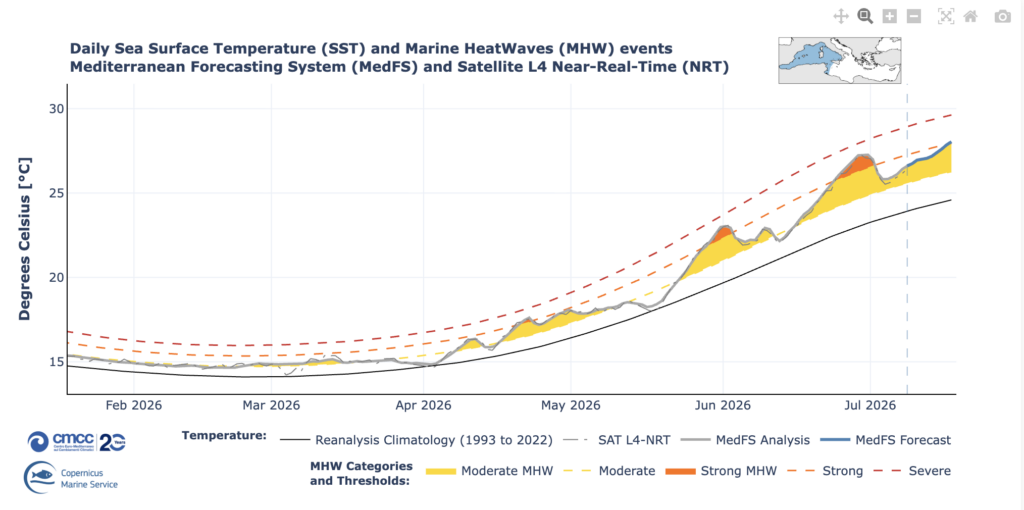
‘The peak of temperatures in the Mediterranean typically occurs between July and August. If there is another heatwave, we expect to see even higher temperatures than those seen in June,’ he said.
CMCC describes the Mediterranean as a climate change hotspot, where marine heatwaves are becoming increasingly common and capable of altering both marine ecosystems and coastal weather.
Experts stress that this does not mean the Mediterranean will suddenly experience frequent hurricanes or storms comparable to those seen in the Atlantic.
However, they say the rapid warming of the sea means the conditions favourable for medicanes are becoming more common, making continued monitoring and preparedness increasingly important as the climate continues to change.