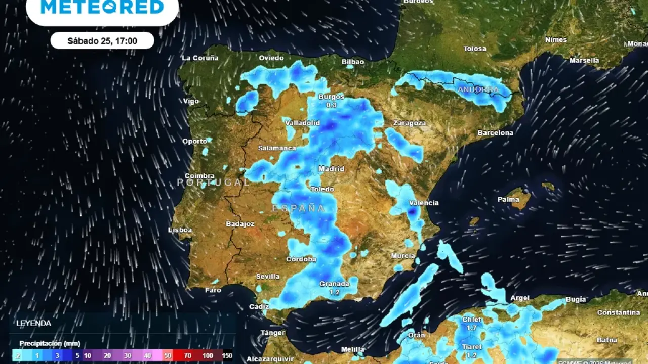

A sharp weather turnaround is on the way for Andalucia, with forecasters warning that a potential DANA could bring storms, hail and sudden downpours after days of near-summer heat.
The week began with unusually high temperatures, with parts of southern Spain climbing above 30C, more typical of June than April.
But this dry spell is expected to break down from Thursday, as unstable air moves in from higher levels of the atmosphere.
Storms, hail and ‘blood rain’
As conditions shift, storms are expected to become more widespread, particularly inland.
These could be intense at times, bringing heavy downpours in short bursts, strong winds and lightning and even hail in some areas.

There is also a chance of Saharan dust mixing with rain, often leaving cars and streets coated in mud.
When will it hit?
The main change is expected from Thursday into Friday, when instability increases across much of Spain, including western and inland parts of Andalucia.
By the weekend, the risk of storms remains high, although forecasts still vary on how widespread and intense they will be.
Uncertainty remains
Weather models differ on how the DANA will evolve.
Some suggest the worst of the storms will stay further north, while others point to a broader impact across southern Spain.
Read more Andalucia news at the Spanish Eye.