Sevilla city has closed all of its parks and the municipal cemetery ahead of a powerful storm expected on Wednesday.
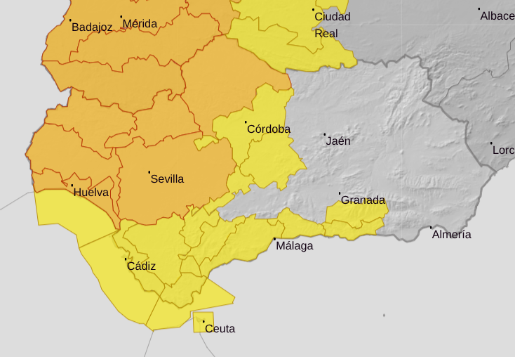
The entire province has been placed on an orange alert by state weather agency Aemet between midnight and 9pm, upgraded from a less serious yellow warning.
Meteorologists predict up to 30mm of rainfall in an hour and winds of up to 80km/hr.
Sevilla City Council urged citizens to follow the instructions provided through official channels and to check road conditions before traveling and to exercise extreme caution.
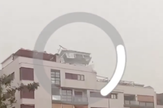
Tornadoes not ruled out in multiple provinces
The Sevilla countryside is forecast to see 30 litres in one hour and 70 litres in 12 hours, and the formation of tornadoes is not ruled out.
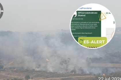
Tornadoes and waterspouts may also be seen in Aracena, Andevalo, Condado, and the Huelva coast.
In Malaga province, the formation of tornadoes and waterspouts cannot be ruled out in Ronda, the Costa del Sol, the Guadalhorce Valley, and Axarquía, due to the atmospheric instability expected during the day.
The dramatic weather is due to the arrival of a low-pressure system located off Cape St. Vincent, according to state weather agency Aemet.
Spokesman Juan de Dios del Pino said the rains will be ‘persistent and consistent’ in the western part of the region.
Aemet has activated warnings for Wednesday in six provinces: Granada, Cordoba, Malaga (including the Costa del Sol), Sevilla, Cadiz and Huelva.
Aemet expects accumulations of up to 60 litres in 12 hours and warns that ‘the possibility of a tornado or waterspout cannot be ruled out’ in Aracena, Andevalo, Condado, and the Huelva coast.
It comes almost exactly a year since a series of waterspouts and tornadoes rocked Huelva’s coast.