
The majority of Spain has been placed under a series of weather alerts following a sweltering weekend.
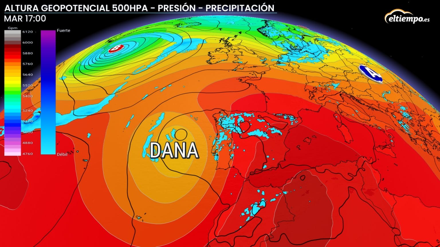
It comes as a dreaded ‘DANA’ is lurking in the Atlantic that is set to sweep in and break the heat with a surge of instability, triggering thunderstorms, strong winds, hail, and the possibility of so-called blood rain.
Over the weekend, the mercury soared in Andalucia, reaching a blistering 42.9C in Moron de la Frontera (Sevilla) and 42.8C in Montoro (Cordoba) on Sunday.
But a turning point arrives on Monday afternoon, according to experts at El Tiempo, as cloud systems begin to build over the Iberian interior.
Thunderstorms are expected to erupt across the plateaus, southern Galicia, Madrid, the central and southern Iberian ranges, and mountain zones of eastern Andalucia.
Expect sudden downpours, gusty winds, and hail, which will be particularly intense in areas like eastern Teruel.
By Tuesday, the DANA will anchor itself over western Spain, amplifying instability across much of the country.
Showers and storms will scatter across central and northern regions, with mountainous zones around the Cantabrian coast, the Pyrenees, and the Iberian System seeing the most dramatic weather. In these areas, lightning, hail, and flash flooding are all on the cards.
Wednesday is shaping up to be the stormiest day, as the DANA gets pulled northward by an upper-level trough.
Showers are expected along the Costa del Sol on this day, including Marbella.
That system will continue stirring the atmosphere, likely unleashing widespread storms, particularly across western Andalucia in the morning, and later across the plateaus, Central System, and the Cantabrian coast.
From Thursday onward, calmer skies return. The ridge responsible for the recent heat will re-establish itself over Spain, restoring some stability – though sporadic showers and storms could still bubble up over the northern highlands.
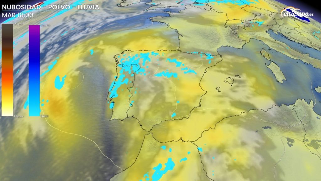
Meanwhile, the DANA’s surface-level effects will drag up warm air laced with Saharan dust, creating a dense ‘calima’ that blankets much of the peninsula and the Balearic Islands.
Expect hazy skies and, in some areas, muddy rain as airborne particles mix with passing showers.
By midweek, the calima will begin shifting east, retreating from the interior and concentrating over the Mediterranean coast, Ceuta, Melilla, and the Balearics.
These areas will see the highest dust concentrations, although overall particle levels shouldn’t reach hazardous thresholds.