
The first storm of the season is set to hit parts of Andalucia this weekend, as the remnants of ex-Hurricane Gabrielle sweep in from the Atlantic.
The system will approach the Gulf of Cadiz on Saturday before unleashing widespread downpours across western Andalucia from Sunday.
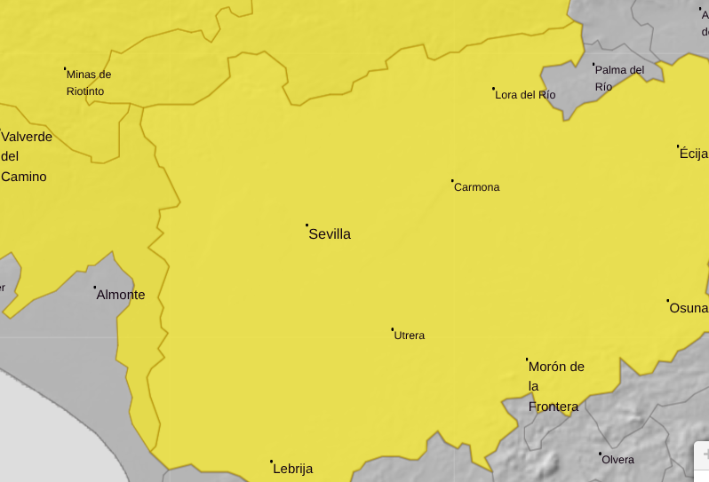
Spain’s state weather agency Aemet has issued yellow weather warnings for heavy rain in Huelva and Sevilla.
Forecasters say rainfall could reach 15 litres per square metre in just one hour, with as much as 30 litres over six hours where showers linger.
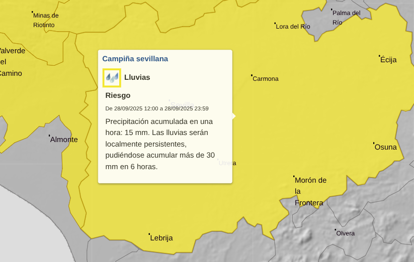
The alerts cover areas including the Sierra de Aracena, Andevalo, Condado and the majority of Sevilla province, including the capital.
On Saturday (27th), skies will start with patches of high cloud, becoming overcast by the afternoon. Temperatures will remain steady, peaking at 32C in Sevilla city, with light variable winds gradually turning westerly.
Sunday: Heavy and persistent downpours
By Sunday (28th), the extratropical storm Gabrielle will push across the south-west of Spain, bringing thick cloud cover and locally intense, persistent rain from midday onwards.
Minimum temperatures will rise slightly, but daytime highs will drop significantly, with Sevilla not exceeding 26C, 27C in Moron de la Frontera and just 21C in Constantina.
Winds will freshen from the south-west before shifting southerly and later easterly as the system tracks east.
Monday: Showers continue into the early hours
The unsettled conditions will persist into Monday (29th) as Gabrielle lingers over southern Spain.
Cloudy skies and showers are expected overnight, clearing gradually as the storm drifts towards the Alboran Sea.
Temperatures will remain steady, with overnight lows of 15–17C and daytime highs between 24–27C. Winds will stay light and variable.
Gabrielle to cross Andalucia from West to East
According to Aemet’s regional delegate in Andalucia, Juan de Dios del Pino, Gabrielle is a ‘small but very energetic system’.
Strong surf is expected along the Cadiz and Huelva coasts this weekend, with waves capable of surging further up beaches than usual, creating dangerous rip currents.
On Sunday, the heaviest rainfall will focus on western Andalucía, while by Monday the south of the region could see thundery downpours and significant accumulations.
Read more Andalucia news at the Spanish Eye.