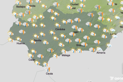

Andalucia is facing a high-risk flood scenario from Wednesday as rivers across the region carry exceptionally high flows.
It comes after weeks of persistent rain and carousels of storms, leading to continued preventive water releases from reservoirs.
The Guadalquivir River Basin Authority (CHG) has warned that the Guadalquivir – which runs through multiple provinces – will rise significantly over the coming days.
Its real-time hydrological system (SAIH) already shows red, orange and yellow alerts across Sevilla, Cordoba, Granada and Jaen, with soils fully saturated and river systems operating close to capacity.
Things are particularly dangerous in traditionally flood-prone areas, including low-lying agricultural plains, urban stretches close to riverbanks and downstream sections of the Guadalquivir.
The Junta has raised the emergency level from 1 to 2, allowing support from other bodies, including the army.
Cadiz on red alert
Cadiz is among the most at risk provinces, with the Grazalema area under a red alert for extreme rainfall on Wednesday.
There are fears that the Guadalete river will once again burst its banks, which last week caused 600 people to be evacuated from their homes.
Floods are highly likely across Grazalema and other inland areas from Wednesday, including rural parts of Jerez de la Frontera.
Malaga on serious alert
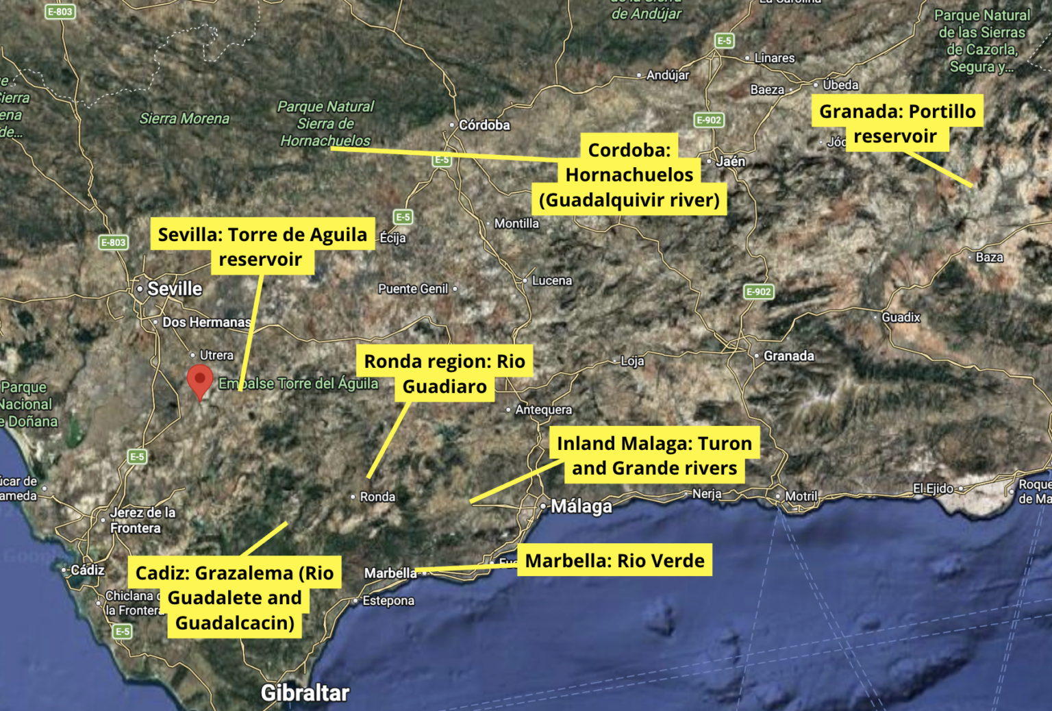
Aemet has classified the risk in the Serrania de Ronda as ‘extraordinary’, with particular attention on the Guadiaro River, which overflowed last week.
Experts have stressed that concern extends beyond the mountain towns – where preventive evacuations have already taken place – to the lower reaches of the Guadiaro and the Genal River.
Monitoring will focus on western Costa del Sol municipalities near the river mouth, notably:
- Casares (especially El Secadero)
- Estepona
- Manilva
In Marbella, attention is also on the Rio Verde. Authorities warn that the La Concepcion Reservoir may continue controlled releases due to accumulated rainfall, which could trigger localised flooding downstream.
Although the alert level is yellow in the Antequera region, experts warn sustained rainfall means towns with high flood susceptibility require close surveillance, including:
- Villanueva del Trabuco
- Villanueva del Rosario
- Bobadilla Estacion
Special attention is being paid to the upper reaches of the Guadalhorce River due to the elevated probability of overflow.
Authorities have also urged extra caution across the Guadalhorce Valley, where tributaries such as the Turon River and Grande River are adding significant volumes to the main channel. Municipalities under watch include:
- Coin
- Alhaurin el Grande
- Alhaurin de la Torre
- Cartama
- Alora
- Pizarra
The river mouth in Malaga is also being monitored closely, as higher upstream flows could translate into rapid rises near the coast.
The most critical point: Torre del Aguila (Sevilla)
The most serious situation is at the Torre del Aguila reservoir, located southeast of El Palmar de Troya in Sevilla province, on the lower Guadalquivir.
This is currently the only site under red alert. According to SAIH data, the dam is releasing around 330 cubic metres per second, forcing continuous controlled discharges to protect the structure.
However, this significantly increases flood risk downstream, particularly across agricultural land and low-lying areas of the lower Guadalquivir basin.
Orange alert: two strategic locations
Two key points are under orange alert, indicating a serious risk of overflow:
- Portillo reservoir (Granada province)
Located on the Castril River, in the eastern headwaters of the Guadalquivir basin. Inflows exceed 30 m3/s, sustained by persistent rainfall in mountainous terrain. - Aznalcazar (Seville province)
On the Guadalquivir River, with flows above 40 m³/s. This area is especially sensitive due to its proximity to historic floodplains, marshland systems and downstream links to Doñana, requiring constant monitoring.
Yellow alert across four provinces
A broad yellow alert remains in place across much of the basin, covering rivers and reservoirs showing high and rising levels.
Sevilla province
- Lora del Rio – Guadalquivir River, exceeding 560 m3/s, one of the highest flows in the system
- Melonares – River Viar
- Gergal – River Rivera de Huelva
- La Minilla – River Rivera de Huelva
- Villanueva del Rio y Minas – Guadalquivir River
- Jose Toran – River Guadalquivir
- Arahal – Guadaira River
- River Viar – increasing inflows from the Sierra Norte
Huelva province
- Zufre – River Rivera de Huelva
- Aracena – Murtigas River
- Huesna – Huesna River
Flows range between 45 and 65 m3/s, playing a crucial role in regulating water entering Seville province.
Cordoba province
- San Rafael de Navallana – Guadalquivir River, around 115 m3/s
- Hornachuelos – Guadalquivir River, exceeding 130 m3/s, one of the most pressured points
- Rio Blanco – tributary of the Guadalquivir
- El Guijo – Guadamatilla River
Jaen province
- Monitoring continues across upper tributaries feeding the Guadalquivir, where continued rain could rapidly translate into higher downstream flows.
What happens next
Aemet forecasts further widespread rainfall, particularly across western Andalucia. While no single extreme event is expected, the persistence of rain could continue pushing river levels higher.
The CHG remains on constant watch and may adjust reservoir releases depending on how conditions evolve.
Authorities are urging residents to exercise extreme caution, avoid riverbanks and flood-prone crossings, and follow emergency instructions closely during what is shaping up to be a decisive week for flood management in Andalucia.
Read more Andalucia news at the Spanish Eye.