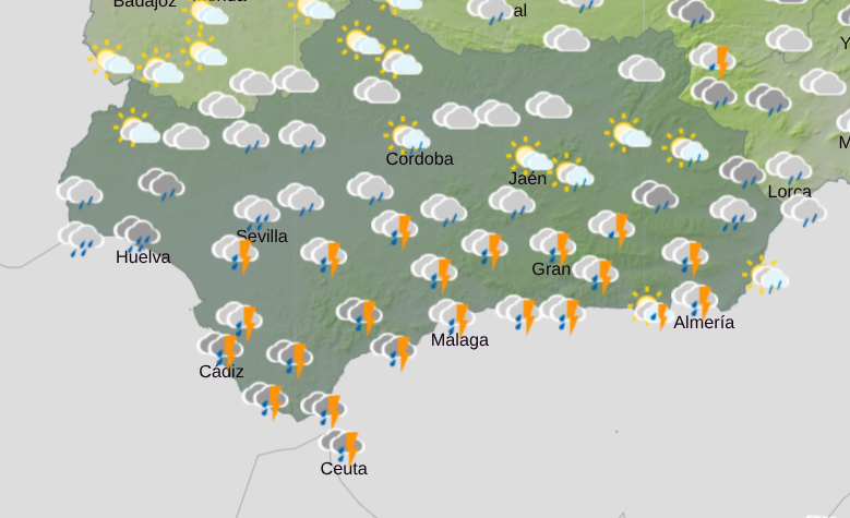
Andalucía is bracing for several days of unstable weather as a DANA (isolated high-altitude depression) moves in – with Wednesday set to be the most intense day of the week.
This type of system, caused by a pocket of cold air dropping down at high levels, creates the perfect conditions for heavy cloud formation and widespread rainfall.
And while showers are expected throughout much of the week, forecasters agree that midweek will see the most significant impact – particularly across southern provinces.
Strait of Gibraltar and Costa del Sol in the firing line
Although rain could appear from early in the week, Wednesday is when the atmosphere is expected to fully destabilise.
The weather front is likely to trigger persistent and locally heavy rainfall.
Current models place the epicentre of the storm across Cadiz province, especially the Sierra de Grazalema and the Strait of Gibraltar area.
This is no coincidence. Moist southwesterly winds slam into the mountain ranges there, forcing air to rise rapidly, cool and condense – a well-known orographic effect that frequently makes Grazalema one of Spain’s wettest spots during Atlantic storms.
It comes after the whole town was evacuated earlier this month following weeks of non-stop rainfall that deemed the area unsafe.
Residents have only recently returned to their homes following extreme flooding.
Costa del Sol also at risk
The instability is expected to spread eastwards, with western Malaga, the Costa del Sol and southern parts of Granada also at risk.
They are all likely to see prolonged and steady rainfall throughout Wednesday.
Further inland – in provinces such as Sevilla and Cordoba – rainfall is expected to be more irregular, alternating between moderate showers and clearer spells.
Almeria’s outlook remains uncertain, as even a slight shift in the DANA’s path could significantly alter rainfall totals there.
Mud rain and reduced visibility
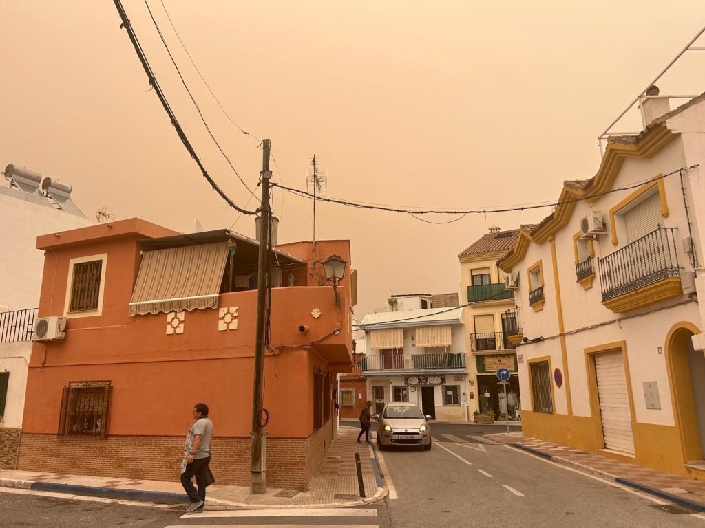
Adding to the unsettled picture is another familiar feature: calima.
Winds will drag Saharan dust into the atmosphere, meaning rainfall could fall as mud rain aka blood rain, leaving cars, streets and buildings coated in a reddish film.
While the dust does not increase rainfall intensity, it will:
- Cloud the skies
- Temporarily worsen air quality
- Reduce road visibility
Risk comes from persistence, not flash flooding
Unlike autumn DANAs known for torrential bursts, the main concern this time is prolonged rainfall in southern areas.
If rain continues for hours over already damp ground, soil saturation could lead to surface runoff, localised water pooling and minor flooding in low-lying zones.
Looking ahead, medium-range forecasts suggest instability may continue into the first half of March.
If the Atlantic pattern holds, rainfall totals in the most exposed areas – particularly around Grazalema – could exceed 200mm by mid-month.
Read more Andalucia news at the Spanish Eye.