
Spain’s third most severe heatwave on record is drawing to a close after more than two weeks of relentless temperatures that placed much of the country under constant alert.
The searing spell, which began on August 3 and matched the 2022 event in intensity, is easing this Monday as maximums drop by as much as 10C.
Relief is arriving thanks to a trough of cool Atlantic air sweeping in from the northwest, displacing the Saharan heat mass that has baked the peninsula.
According to Aemet spokesperson Jose Luis Camacho, the shift is bringing instability, with storms and showers already spreading across northern and eastern regions.
READ MORE: Watch: Freak storm surge in Granada forces mass evacuation of beach
Rainfall has been reported in Galicia, the Pyrenees and the Cantabrian coast, with heavier downpours forecast in eastern Iberia.
Temperatures still sweltering in the south
Despite the wider cooldown, the Guadalquivir Valley and parts of the southeast could still nudge 40C in the coming days, while nights in Andalucia and the Mediterranean basin will continue to hover above 20C.
In contrast, Burgos, Leon, Palencia and Soria may see nighttime lows near 11C – a stark reminder of the north-south divide.
Meteorological experts say Saharan dust will also disperse this week as fresher air takes hold.
Cities such as Sevilla, Cordoba and Badajoz are expected to see highs capped at 34C by midweek – still hot, but no longer the extremes of 44C seen this past weekend.
Andalucia outlook
In Andalucia, residents can expect a gradual easing of the oppressive heat, though relief will be uneven.
Sevilla, Cordoba and Jaen are forecast to remain in the mid-30s through Wednesday before dipping further by the weekend.
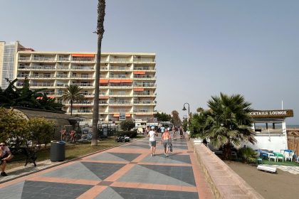
Coastal areas along Malaga, Cadiz and Huelva will benefit from fresher Atlantic breezes, with daytime highs in the low 30s and more comfortable nights.
The Alboran Sea, however, may see a brief rebound in temperatures towards Thursday and Friday, with parts of eastern Malaga and Granada’s coastal strip approaching 37–38C.
Inland valleys will stay warm and sticky at night, rarely dropping below 22C.
AEMET notes that isolated thunderstorms could spill into eastern Andalucia by midweek, particularly in Granada and Almeria provinces, though widespread rainfall remains unlikely.
By Sunday, models point to a more stable pattern, with highs mostly in the low-to-mid 30s across the region – warm, but a far cry from the deadly extremes of recent weeks.
Alerts still in place
Red weather warnings remain in force in the Vegas del Segura and southern Alicante, where mercury has climbed to 44C and 42C respectively.
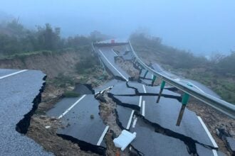
Orange warnings are active in the Pyrenees for storms dumping more than 30 litres of rain per square metre in 24 hours.
Meteored’s Samuel Biener warns that Spain is now bracing for a new phase of ‘wild weather’, with strong winds absorbed into the jet stream expected to unleash more heavy rain and thunderstorms across Catalonia, Valencia, the Balearics and even Tenerife in the Canaries.
Read more Andalucia news at the Spanish Eye.