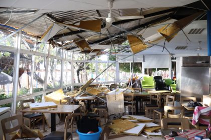
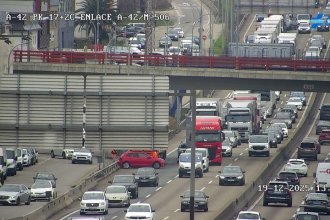
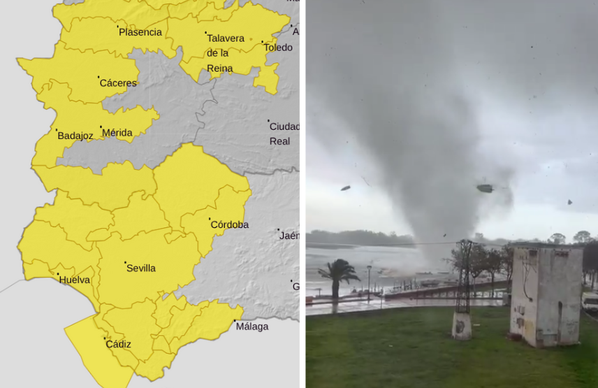
Weather experts have warned of potential tornadoes and water spouts in Andalucia this week.
A ‘carousel’ of Atlantic storms is bringing intense showers and strong winds, with five provinces in the region placed on alert over the next two days.
The dramatic weather on Tuesday and Wednesday is due to the arrival of a low-pressure system located off Cape St. Vincent, according to state weather agency Aemet.
Meteorologists said the system will enter Andalucia through the north of Cadiz.
Spokesman Juan de Dios del Pino said the rains will be ‘persistent and consistent’ in the western part of the region.
Aemet has activated warnings for Wednesday in five provinces: Cordoba, Malaga (including the Costa del Sol), Sevilla, Cadiz and Huelva.
In the latter two, the warning will come into effect from 8pm on Tuesday.
Aemet expects accumulations of up to 60 litres in 12 hours and warns that ‘the possibility of a tornado or waterspout cannot be ruled out’ in Aracena, Andevalo, Condado, and the Huelva coast.
It comes almost exactly a year since a series of waterspouts and tornadoes rocked Huelva’s coast.
In addition, coastal phenomena will threaten the Cadiz, where the forecast indicates southwesterly gusts of 50 to 61 km/h (force 7).
The Meteored weather service said: ‘We are on the verge of a new change in the weather in Spain, which will result in almost widespread rain due to the arrival of a series of low-pressure systems and fronts from the Atlantic.
‘Tomorrow (Tuesday) a front will arrive that, from midday onwards, will bring rain to Galicia, Castilla y Leon, Extremadura and Andalucia, being locally intense and stormy.’
The rains will continue between Thursday and Sunday throughout the region, although they will be of ‘lower intensity’ and there is a possibility of ‘some clear spells.’
Read more Andalucia news at the Spanish Eye.

