
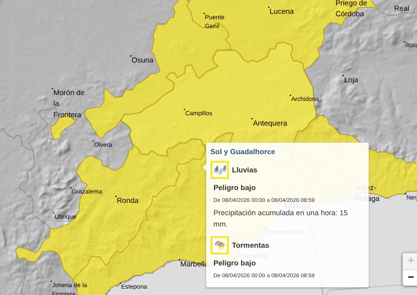
The entire province of Malaga has been placed on yellow alert for heavy rain and thunderstorms as a sharp change in weather sweeps across Andalucia.
Spain’s state weather agency Aemet has issued the warning for Wednesday, with forecasts of intense downpours delivering up to 15 litres of rain per square metre in just one hour.
Storms to hit overnight
The alert is in place across the whole province – including the Costa del Sol, Axarquía, Ronda, Antequera and the Guadalhorce Valley – from midnight until 9am, when the heaviest rain is expected.
The change comes after days of almost summer-like temperatures, with meteorologists confirming that a cold drop system moving in from the Atlantic will bring rain, storms and a noticeable fall in temperatures.
Conditions are expected to deteriorate from Tuesday night, with the worst of the weather arriving in the early hours of Wednesday.
Calima and unsettled skies
Alongside the rain, dust-laden skies – known as calima – is also forecast, particularly through Wednesday and into Thursday, giving skies a hazy appearance.
Neighbouring areas bordering Sevilla and Cordoba are also under weather warnings for rain on Wednesday, currently the only other parts of Andalucia affected.
Temperatures plunge
The shift will be felt most sharply inland. In areas like Antequera, temperatures are set to drop by around 10C – from highs of 25C earlier in the week to just 15C on Wednesday.
On the coast, the fall will be less dramatic but still noticeable, with temperatures settling around 20C after peaking near 25C in recent days.
While no further official alerts have been issued beyond Wednesday morning, unsettled weather is expected to continue.
Rain could persist into Thursday and Friday, with light to moderate showers and continued dust in the air.
Early forecasts also suggest more rain over the weekend, although likely less intense than the midweek storms.