
Andalucia is bracing for a dramatic weather U-turn after a near-perfect Semana Santa of sunshine and soaring temperatures.
After days of clear skies and highs pushing 30C, the region is now set for rain, thunderstorms, Saharan dust and a sharp temperature drop.
The mercury is expected to plunge by as much as 12C in parts of southern Spain by midweek.
From summer heat to storms in hours
The sudden shift, which begins on Monday night, is being driven by a cold low-pressure system moving into the southwest of the Iberian Peninsula, dragging in cooler air, moisture and dust from North Africa.
According to state weather agency Aemet, skies will quickly turn from clear to unsettled, with clouds building from west to east and the first showers arriving as early as Monday afternoon.
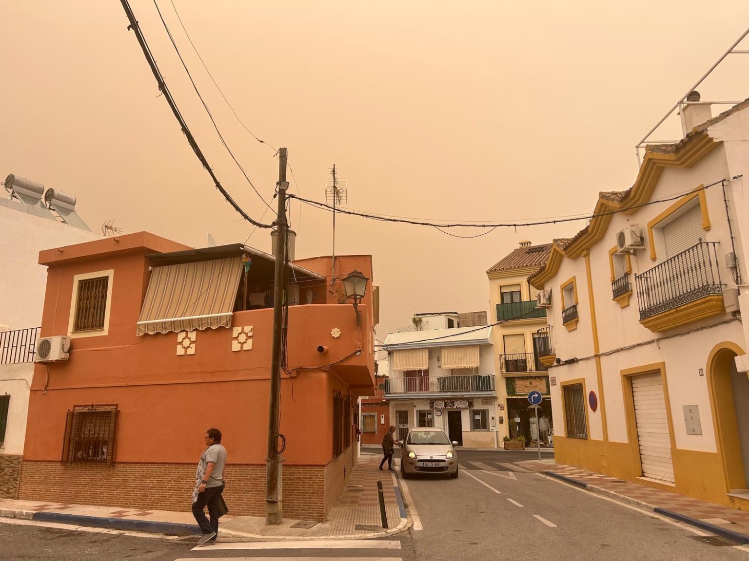
Rain is expected to hit western provinces such as Sevilla and Huelva first, potentially falling as muddy ‘blood rain’ due to suspended Saharan dust.
Calima and strong winds hit first
Weather expert Jose Luis Escudero has warned that the so-called calima will begin spreading across much of Andalucia from Monday, lingering into Tuesday night before briefly easing – only to return again later in the week.
At the same time, strong Levante winds are battering parts of the Cadiz coast, with gusts reaching up to 80km/hr and rough sea conditions offshore.
Heavy rain and storms midweek
The most unstable conditions are expected on Tuesday and Wednesday, when an Atlantic front strengthens over southern Spain.
Forecasts from Meteored suggest downpours could become locally intense, with thunderstorms possible, particularly across central Andalucia.
Cities like Sevilla, Cordoba and Granada could see highs fall by up to 12C compared to the Easter weekend.
Temperatures plunge across the region
By midweek, daytime temperatures are expected to range from around 16C in Jaen to 23C in Almeria, in a stark contrast to the near-summer heat recorded just days earlier.
Conditions are expected to improve from Thursday, with rain easing and skies beginning to clear across much of the region.
However, uncertainty remains heading into the weekend, with the possibility that the system could evolve into a DANA (isolated high-altitude depression), potentially bringing another round of showers and cooler weather.
Read more Andalucia news at the Spanish Eye.