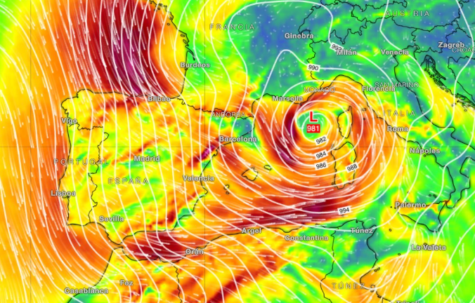

Storm Oriana will drag Andalucia back under an umbrella of weather alerts Friday – after brief respite from the wind and rain on Thursday.
Temperatures are set to climb above 20C on the Costa del Sol today, even reaching as high as 24C in some areas.
But don’t pack away the coats and umbrellas just yet, as Oriana looks set to change that on Friday.
State weather agency Aemet warns that the storm will bring very strong wind gusts on Friday and Saturday, alongside coastal disruption, heavy rain and snowfall at relatively low altitudes in some areas of Spain.
In Malaga province, the worst of the weather is expected – once again – in the Serrania de Ronda and the mountainous western fringes of the Costa del Sol.
Forecasts indicate accumulated rainfall of up to 40mm per square metre over 12 hours, with some areas potentially exceeding 60mm in 24 hours.
While not as extreme as previous recent episodes, the issue is that the ground is already saturated after weeks of unsettled conditions. Any further downpours could aggravate existing problems.
Yellow warnings have been issued across the province for westerly winds – both poniente and terral – with gusts reaching up to 70 km/h. The warning period is set to run from 9am on Friday through to midnight.
Western Andalucia
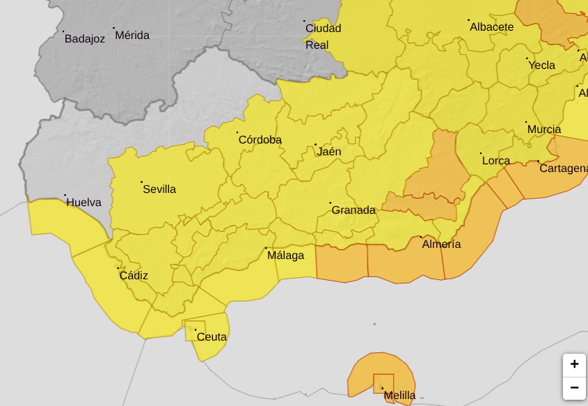
In the west of Andalucia, the entire provinces of Sevilla and Cadiz are on a yellow alert on Friday for strong gusts of up to 70km/hr until around 9pm.
Within Cadiz, Grazalema is also, once again, on a yellow warning for intense rainfall between 6am and midnight.
Aemet predicts that up to 100mm of rain per square metre could fall over 24 hours.
Eastern Andalucia
In the eastern half of the region, orange warnings are in place in inland Almeria for strong gusts of up to 90km/hr.
The whole provinces of Granada, Cordoba and Jaen are under yellow warnings for wind, with gusts reaching maximums of between 70 and 80km/hr.
Read more Andalucia news at the Spanish Eye.