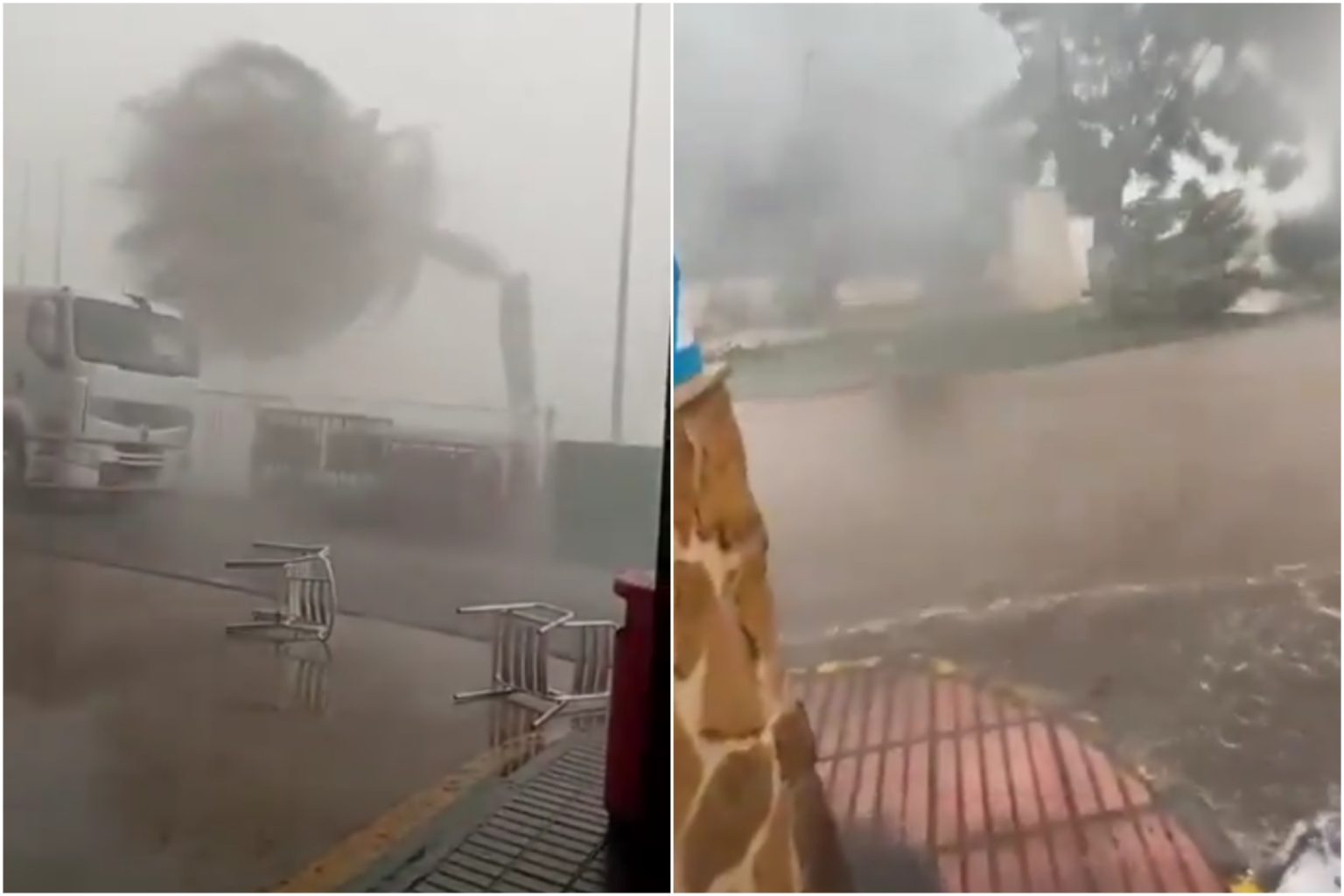

An extreme downpour across eastern and southeastern Spain has sparked multiple flash floods.
Video footage shared online from Callosa de Segura, in the Alicante region of Vega Baja, shows palm trees being snapped in half amid battering 100km/hr winds.
It comes as much of the region was placed on orange and yellow alerts on Monday for extreme rainfall and strong winds.
AEMET, also issued a red alert for the southern coastal and pre-coastal areas of Tarragona Monday due to the threat of torrential rain.
Warnings are in effect from 3pm to 9pm, with a staggering 90mm of rain possible in just one hour, raising the risk of flash flooding and sudden river surges.
Residents are urged to exercise extreme caution during this period
This heightened warning comes amid a broader weather emergency. Catalonia’s Civil Protection has activated INUNCAT, the region’s Special Flood Emergency Plan, and Sanitation services are monitoring potentially dangerous river and stream levels.
Meanwhile, the Servei Meteorològic de Catalunya (Meteocat) has raised the danger level to 5 out of 6, forecasting up to 40 litres per square meter in just 30 minutes, and possibly 100 litres in 24 hours.
The hardest-hit areas include Tarragonès and Baix Camp, with alert zones extending later into Baix Ebre and Montsià this afternoon.
In response to the threat, the Catalan government has sent Es-Alert messages to residents in Baix Ebre and Montsià, urging them to avoid unnecessary travel and steer clear of flood-prone areas.
Is Andalucia affected?
The State Meteorological Agency (AEMET) has activated a yellow-level alert for Andalucía’s southern coastline – specifically the Costa del Sol – this coming Tuesday, warning of heightened marine and wind-related conditions.
According to AEMET, the alert will be in force from noon and covers the entire coastline of Málaga province, stretching from Manilva in the west to the Axarquía region in the east.
Gusty winds from the west and southwest are expected, generating force 7 breezes with speeds ranging from 50 to 60 km/h, accompanied by waves of 2 to 3 metres in height.
Meteorology expert José Luis Escudero noted that the often-stifling “terral” wind will be a key driver of the conditions, though AEMET assures the high temperatures usually associated with it will not materialize this time — daytime highs should reach around 30C, with nighttime lows near 23C in Málaga city.